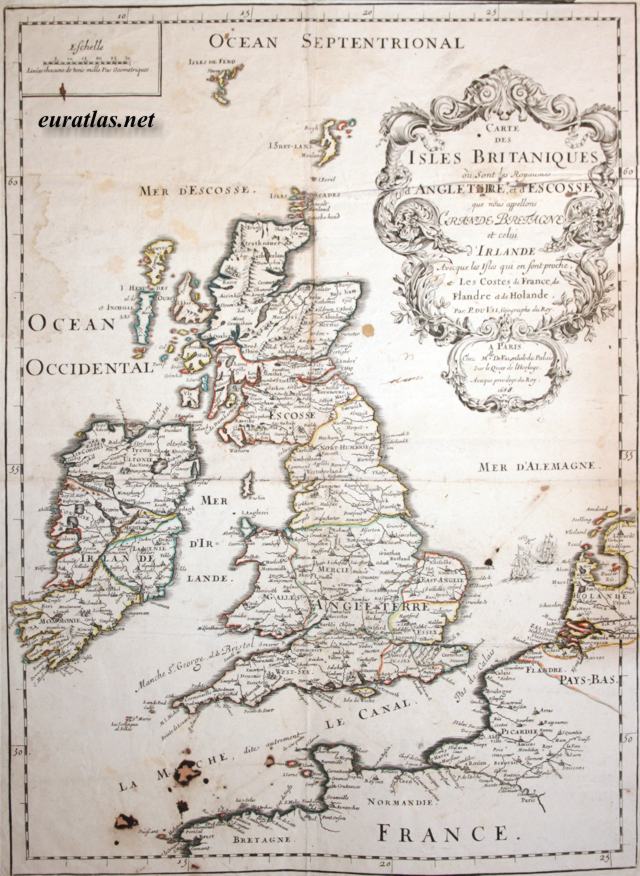
| The British Isles, 1688: main map |
|
|
|
|
| Whole Map |
| Description |
|
|
 |
 |
 |
 |
 |
 |
 |
 |
 |
 |
 |
 |
 |
 |
 |
 |
|
|||||||||||||||||||||||||||
|
|
||||||||||||||||||||||||||
|
|
General view of the map of the British Isles, England, Scotland, Wales and Ireland published by du Val in 1688. | ||||||||||||||||||||||||||