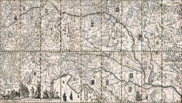
| Old Geography Map of the Alpine and Danube Lands |
|
|
|
|
| Main Map |
| Description |
|
|
 |
 |
 |
 |
 |
 |
 |
 |
 |
 |
 |
 |
 |
 |
 |
 |
 |
 |
|
|||||||||||||||||||||||||||||
|
|
|
|||||||||||||||||||||||||||
|
|
An
antique map of the Alpine and Upper Danube Basin countries with parts
of Northern Italy and Dalmatia, no place, no date. The bottom left-hand
leaf wears the mention "Elias Boeck a. H. sculps. a. V." Thus, this map
was presumably engraved, about 1715, by Elias Boeck ot Boeck, also
called Heldenmuth, 1679 - 1747, who lived in Augsburg. |
||||||||||||||||||||||||||||