 |
| Principal |
| Description |
 |
 |
 |
 |
 |
 |
 |
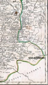 |
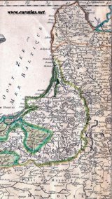
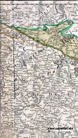
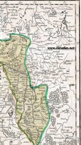
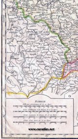
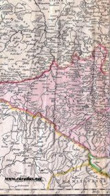
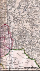
| Carte du Royaume de Pologne, réalisée en 1752 par Gilles et Didier Robert de Vaugondy. Sur ce document, les frontières apparaissent telles qu'elles existaient 20 ans avant le premier partage de la Pologne. |
Map of the Kingdom of Poland, engraved in 1752 by Gilles and Didier Robert de Vaugondy. On this document, the boundaries are shown as they were 20 years before the First Partition of Poland. |