Euratlas
Euratlas-Info Members' Area            

Members'Area
An Easy Map of Europe in 1950                        Download in .jpg


Map of Europe 1950


An easy political map of Europe in 1950, showing the countries without their administrative divisions. The 'lost' states (Austria and Libya under foreign occupation, Two Germanies, Yugoslavia, SSSR etc.) are listed in the map legend.
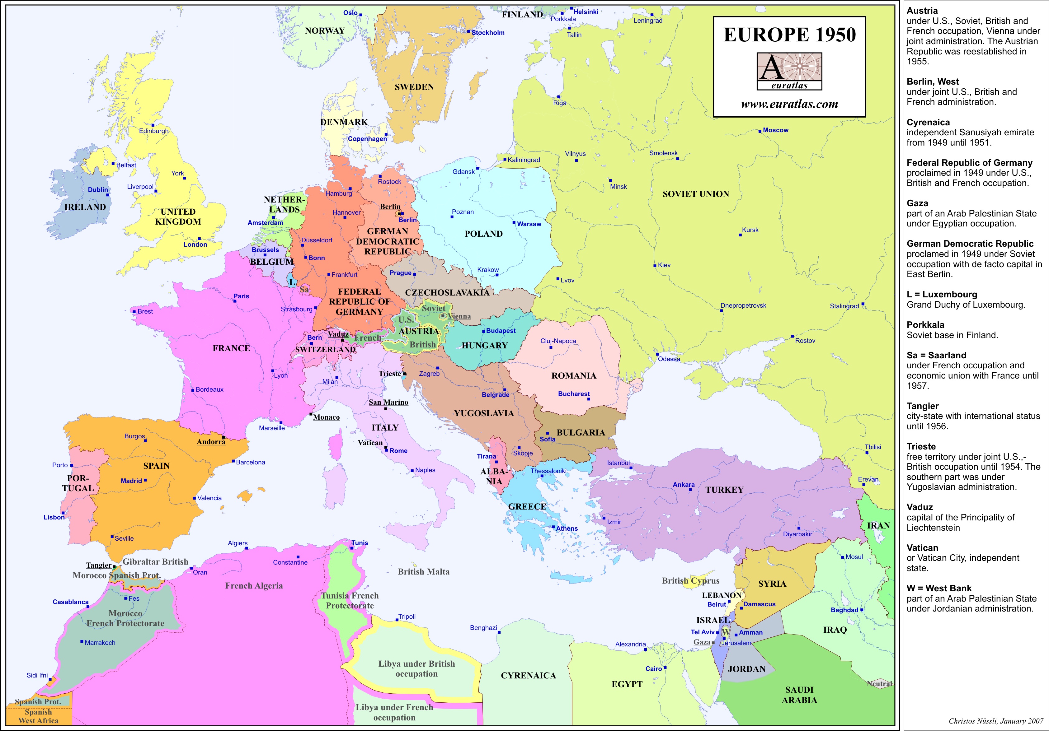
This map is not provided in the Periodical Historical Atlas of Europe.
Size of the map: 3370 x 2350 x 300 px or 28.5 x 19.8 cm.
You can use this file for illustration or educational purposes if you mention the source:
"© Euratlas-Nussli 2008, www.euratlas.com".


For Euratlas-Info subscribers only.

Enter e-mail address: