

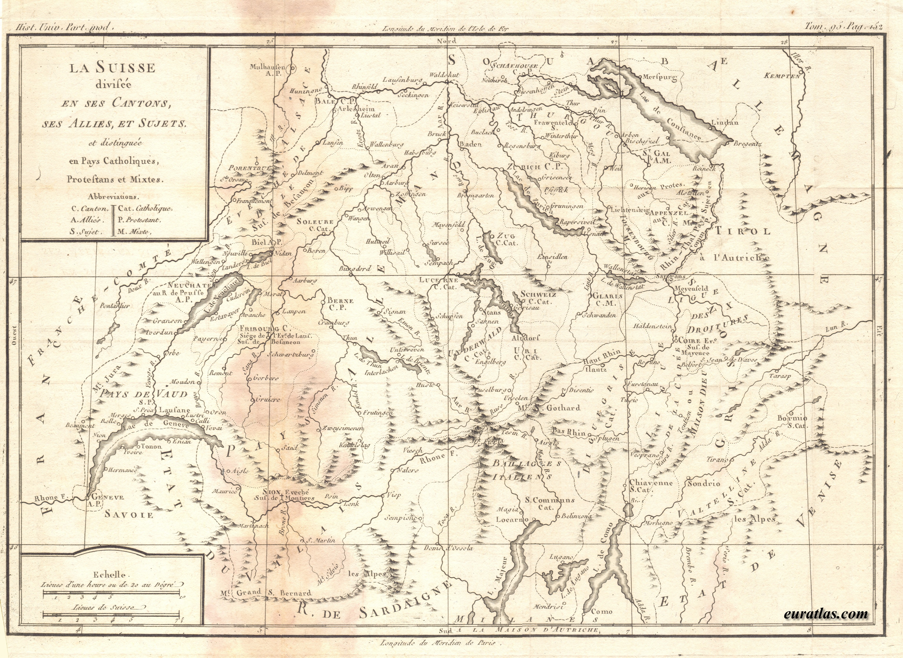
This map is provided in .jpg format at the size of 3780 x 2757 x 300 pixels so that it can be printed with a good quality.
For Euratlas-Info subscribers only.
| Enter e-mail address: |
|---|
|
Euratlas-Info Members' Area | |||
| Map of Switzerland about 1770 Download in .jpg | ||||
|
| ||||
| Switzerland, divided in Cantons and ses Allies et
Subjects, anddd distinguished between Catholic, Protestant and Mixed Lands, presumably by Desnos, about 1770. This map is provided in .jpg format at the size of 3780 x 2757 x 300 pixels so that it can be printed with a good quality. For Euratlas-Info subscribers only.
| ||||