Euratlas Home>
Historical Maps>
History of Europe>
Europe 1600
Fly over a highly detailed map of Europe in year 1200 and discover every polity
About
Privacy
Site Map
Contact
Europe in Year 1600
Historical Maps
Geography Maps
Europe Atlas
World Atlas
Antique Maps
Antique Cartography
Lesage Atlas 1808
Peutinger Map
Europe Photos
Countries of Europe
Time Pictures
Euratlas
Shop
Member's Area
Historical Maps
Middle East History
Roma
World History
History of Europe
Year 2000 A.D.
Year 1900 A.D.
Year 1800 A.D.
Year 1700 A.D.
Year 1600 A.D.
Year 1500 A.D.
Year 1400 A.D.
Year 1300 A.D.
Year 1200 A.D.
Year 1100 A.D.
Year 1000 A.D.
Year 900 A.D.
Year 800 A.D.
Year 700 A.D.
Year 600 A.D.
Year 500 A.D.
Year 400 A.D.
Year 300 A.D.
Year 200 A.D.
Year 100 A.D.
Year 1 A.D.
Explanation
Map Legend
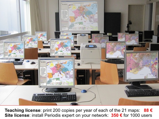
Bibliography 1600
Detailed Maps
Aegean Area
Apennine Peninsula
Iberian Peninsula
Oder-Dnieper
Pyrénées-Rhine
Rhine-Oder
Rhine-Rhône
This map is in
Sovereign States
mode,
zoom in
to display the dependencies
Europe Main Map at the Beginning of the Year 1600
Northwest
Northeast
Southwest
Southeast
Aachen (S)
Geneva (D)
Moks (D)
Schleswig-Holstein-Gottorp (S)
Abkhazia (D)
Genoa (S)
Monaco (D)
Schwabisches Hall (S)
Adana (D)
Genç (D)
Monaghan (D)
Schweinfurt (S)
Ahlat (D)
Gersau (D)
Montenegro (D)
Scotland (S)
Algiers (D)
Gex (D)
Montferrat (D)
Sedan-Bouillon (S)
Amadya (D)
Ghadamès (D)
Morocco (S)
Shatak (D)
Anah (D)
Goslar (S)
Mukriyan (D)
Shavsheti (D)
Andorra (S)
Grandson (D)
Mulhouse (D)
Sigmaringen (S)
Ansbach-Kulmbach (S)
Grasburg (D)
Mumhan (D)
Sijilmassa (D)
Antrim (D)
Guria (D)
Murten (D)
Sirvan (D)
Athos (D)
Göksun (D)
Muscovy (S)
Small States (S)
Augsburg (S)
Habsburg (S)
Mzab (S)
Soran (D)
Baden (D)
Hakkari (D)
Mühlhausen (S)
Souss (D)
Baden (S)
Hamburg (S)
Nassau (S)
Southern Netherlands (D)
Banu Sahari (P)
Hananeshas (P)
Nemenchas (P)
Spain (S)
Banu Sellab (P)
Hanyan (P)
Netherlands (S)
Stenay (D)
Bashkala (D)
Haraktas (P)
Neuchâtel (D)
Stettin (S)
Bavaria (S)
Hazro-Tercil (D)
Nevers (D)
Suliots (D)
Beni Amer (S)
Hazzo (D)
Nogai (D)
Sulzbach (S)
Beni Snassen (P)
Hechingen (S)
Nuremberg (S)
Svaneti (D)
Bernburg (S)
Hesse-Darmstadt (S)
Orange (S)
Sweden (S)
Besançon (S)
Hesse-Kassel (S)
Ossetians (P)
Swiss Cantons (S)
Biberach (S)
Hosap (D)
Ottoman Empire (S)
Terek Cossacks (D)
Bitlis (D)
Imereti (D)
Ouargla (D)
Teschen (D)
Boisbelle-Henrichemont (D)
Isny (S)
Oulaid Nail (P)
Thomond (S)
Brandenburg (S)
Jülich-Berg (S)
Oulaid Sidi Sheikh (P)
Three Leagues (D)
Bremen (S)
Kabards (P)
Palatinate (S)
Thurgau (D)
Brieg (D)
Karachays (P)
Palatinate-Neuburg (S)
Tomarza (D)
Brunswick-Lüneburg (S)
Kartli (S)
Palu (D)
Touggourt (D)
Brunswick-Wolfenbuttel (S)
Kaufbeuren (S)
Papal States (S)
Transylvania (D)
Buchhorn (S)
Kempten (S)
Parma (S)
Traras (S)
Calenberg (D)
Kilis (D)
Passau (S)
Trier (S)
Castro (S)
Kouko (D)
Pertakrek (D)
Tripoli in Africa (D)
Circassians (D)
Kulp (D)
Pertek (D)
Tunis (D)
Cizre (D)
Köthen (D)
Piombino (S)
Tuscany (S)
Clermontois (D)
Labbes (S)
Poland-Lithuania (S)
Tyrone (S)
Cologne (S)
Laghouat (S)
Pomerania-Wolgast (S)
Ulm (S)
Cologne (S)
Lauenburg (S)
Pontremoli (D)
Ultramontani (D)
Connaught (S)
Lebanon (D)
Porrentruy (S)
Urbino (D)
Cossacks (D)
Leutkirch (S)
Prussia (D)
Vaghashkert (D)
Courland (D)
Liegnitz (D)
Ragusa (D)
Valais (D)
Crimea (D)
Lindau (S)
Ratzeburg (S)
Venice (S)
Dahra (D)
Livane (D)
Ravenstein (D)
Vinschgau (D)
Dawawidas (P)
Liège (S)
Regensburg (S)
Vostan (D)
Denmark (S)
Lorraine (S)
Reutlingen (S)
Waldeck (S)
Dessau (D)
Lucca (S)
Rothenburg (S)
Wallachia (S)
Dombes (D)
Lübeck (S)
Rottweil (D)
Wetzlar (S)
Don Cossacks (D)
Mainz (S)
Sagman (D)
Württemberg (S)
Dortmund (S)
Man (D)
Saint Gall (D)
Yerevan (D)
Décapole (S)
Mani (D)
Saint John (S)
Zagorohoria (D)
East Frisia (S)
Mantua (S)
Salzburg (S)
Zenatas (P)
Engelberg (D)
Massa (S)
San Marino (S)
Zerbst (S)
England (S)
Masserano (S)
Sargans (D)
Zeytun (D)
Eğil (D)
Mecklenburg-Güstrow (S)
Savoy (S)
Zweibrücken (S)
Fez (D)
Mecklenburg-Schwerin (S)
Savur (D)
Zyrians (P)
Figuig (S)
Memmingen (S)
Saxe-Coburg (S)
Çabakcur (D)
France (S)
Mingrelia (D)
Saxe-Eisenach (S)
Çermik (D)
Frankfurt (S)
Mirdita (D)
Saxon Duchies (S)
Échallens (D)
Gaster-Sargans (D)
Modena (S)
Saxony (S)
Überlingen (S)
Conditions of Use
Privacy Notice
Contact
Euratlas - 2001-2012