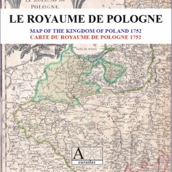

France 1783: the roads of France during the Age of Enlightenment
 Security policy
(edit with the Customer Reassurance module)
 Delivery policy
(edit with the Customer Reassurance module)
 Return policy
(edit with the Customer Reassurance module)
Description
The Itinerary Map of France 1783 shows the road networks as it was in the 18th and 17th centuries. The provinces of the Ancien Régime are clearly legible.
A town index allows a fast and direct acces to the requested places and a short chronology mark the main events of French history in the 18th century.
Requirements
Platform independent data, .html format.
Web-browser required. Internet connection not necessary.
Main Features
- 35 scanned .jpg format map sheets showing France in 1783.
- France 1783 is presented on html pages allowing an easy and fast navigation.
- Size of each map sheet: 1666 x 2342 pixels x 295 dpi.
- 210 real size sections of the main map, 833 x 780 pixels x 295 dpi each.
- Real size of the whole map, same as the original: ~100 cm x ~100 cm.
- Bilingual index with ~950 places in France and adjacent countries.
France 1783: the roads of France during the Age of Enlightenment